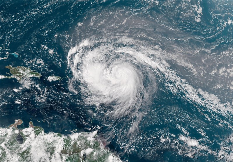
Hurricane Erin Becomes One of Fastest-Intensifying Storms in Atlantic History
TEHRAN (Tasnim) – Hurricane Erin rapidly strengthened into one of the fastest intensifying storms in Atlantic history, briefly reaching Category 5 before weakening to a Category 4 as it tracks north of the Caribbean.
The storm jumped from a Category 1 with 75 mph winds on Friday morning to Category 5 with nearly 160 mph winds just over 24 hours later, placing it among the most rapidly strengthening hurricanes ever recorded in the basin. It is forecast to regain Category 5 strength as it completes an eyewall replacement cycle, expanding its wind field.
As of Saturday evening, Erin was about 150 miles northeast of San Juan, Puerto Rico and 160 miles northwest of Anguilla, with maximum sustained winds near 150 mph, the US National Hurricane Center (NHC) said. Tropical storm watches remain in effect for parts of the Leeward Islands and the Turks and Caicos, and a flash flood warning was issued for northern Puerto Rico.
Forecasters expect Erin to avoid direct landfall, instead curving north-northeast between the US East Coast and Bermuda next week. Even without a strike, the NHC warned the storm will bring dangerous surf and rip currents to the Bahamas, much of the US East Coast, and Atlantic Canada.
Rapid intensification, defined as an increase of at least 35 mph in winds within 24 hours, has become more common as warmer ocean waters fuel storms. Erin is the Atlantic’s first major hurricane of the 2025 season and one of only 43 Category 5 storms ever recorded in the basin. It is the 11th such storm since 2016, underscoring an unusual concentration of extreme systems.
The storm’s impacts are already being felt across the northeastern Caribbean, where gusty winds and heavy rainfall of up to six inches in some areas could trigger flash floods and mudslides. US Coast Guard officials closed ports in Puerto Rico and the US Virgin Islands to inbound traffic in anticipation of dangerous seas.
By Sunday, Erin had re-intensified into a Category 4 storm after an eyewall replacement cycle, located about 965 miles (1,555 km) south-southeast of Cape Hatteras, North Carolina, with sustained winds of 130 mph (215 kph).
“Some additional strengthening is expected over the next 12 hours followed by gradual weakening,” the NHC said.
The storm is expected to persist into next week while expanding significantly in size, posing continued risks of rough seas and coastal hazards even as it weakens.


